
A survey team feeds multibeam sonar or bathymetric data into a detection model. The model flags a seafloor anomaly as a likely wreck. No diver has entered the water. No ROV has crossed the site. No artifact has been lifted, photographed at close range, or logged into a conservation lab. Yet a client, insurer, coastal state, archaeologist, or competitor may already care very much about what just happened.
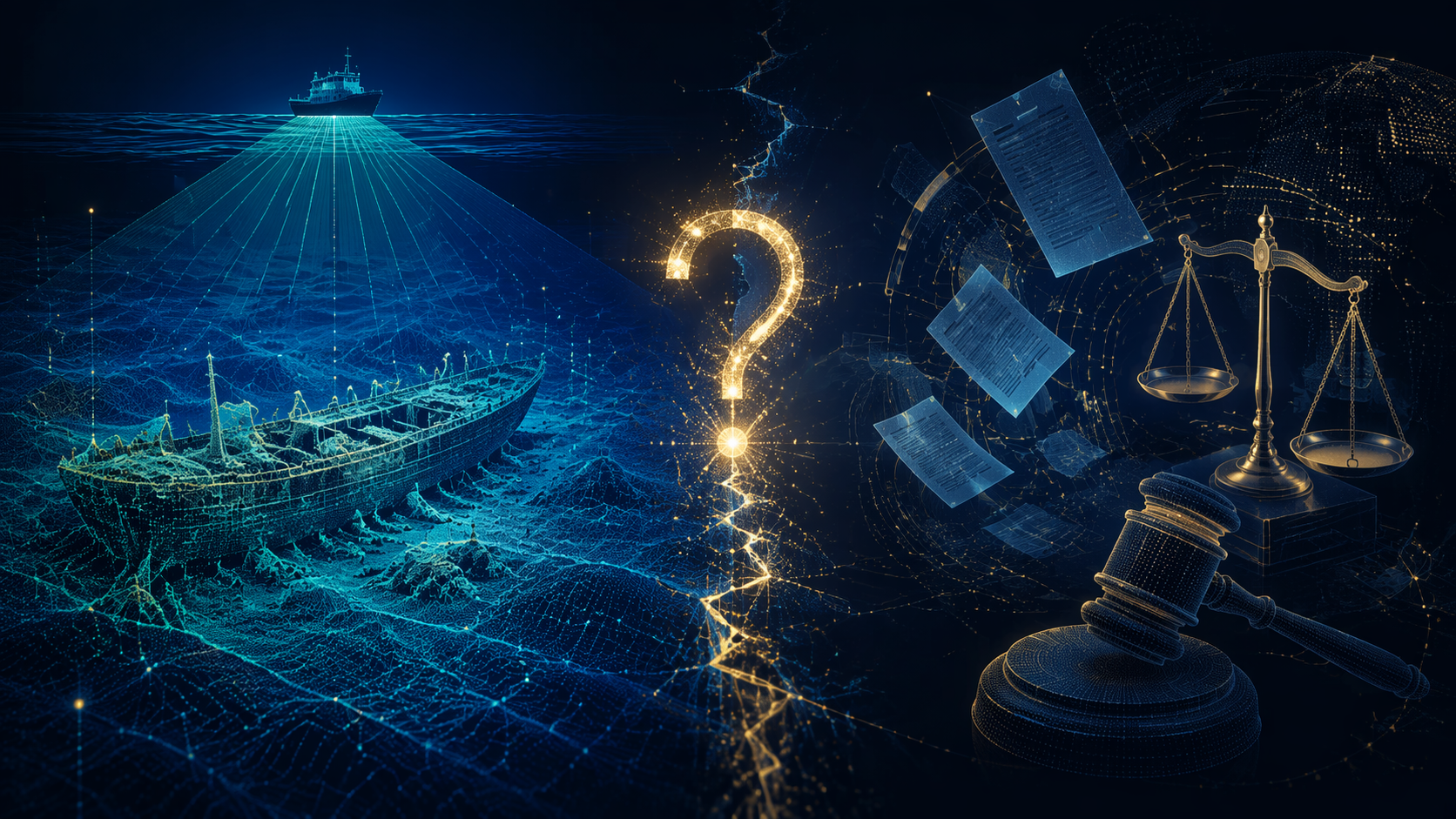
That is the practical problem at the intersection of AI shipwreck discovery, maritime law, and cultural heritage protection. Automated detection does not simply make wreck hunting more efficient. It moves the legally sensitive moment earlier, into the survey room or data-processing workflow, before the traditional acts that admiralty and heritage law have been built to recognize.
The technology is no longer an academic curiosity. In 2021, Leila Character described a machine-learning model that reached 92% accuracy in detecting shipwrecks from multibeam sonar data, trained on NOAA and US Navy Underwater Archaeology Branch datasets covering US coasts and Puerto Rico.[1] That figure deserves attention, but also caution: it measures performance within the conditions and training context of that study, not a general legal truth about every seabed, sensor, or wreck class.
The scale problem has sharpened since then. ShipwreckFinder, released as a QGIS plugin in June 2025, uses deep learning to detect wrecks in multibeam sonar data and was trained on Thunder Bay National Marine Sanctuary and INFOMAR Irish coastal data; the authors report that it outperformed classical machine-learning methods and ArcGIS-based approaches.[2] The legally important point is not that one tool is definitive. It is that automated wreck detection is moving into software environments used by ordinary surveyors, researchers, consultants, and public agencies.
Other work points in the same direction. A 2025 Journal of Archaeological Science study combined machine learning with topographic inference for shipwreck detection in bathymetry data, showing that the field is not confined to one model architecture or one research group.[3] NOAA Ocean Exploration’s 2025 EX-25-04 expedition was also designed to test automated detection models on new survey data, including a “Shipwreck Sprint” exercise with the US Navy’s Underwater Archaeology Branch.[4] Taken together, these projects make the legal ambiguity operational rather than hypothetical.
The anomaly is not yet a wreck in law
An AI output is an evidentiary event. It may be a useful lead, a reason to preserve raw files, a reason to stop a planned intrusive survey, or a reason to call a coastal-state authority. It is not, by itself, possession. It is not title. It is not a salvage award. It is not a judicial finding that the target is a protected cultural object.
That distinction is easy to lose in public descriptions of AI discovery. “AI found a shipwreck” sounds simple because it collapses several steps: data acquisition, model inference, human review, geospatial confirmation, archaeological assessment, legal classification, and sometimes physical intervention. Maritime lawyers do not have the luxury of collapsing those steps, because different duties and claims may attach at different points.
| Event | What has actually happened | Why the legal result remains unsettled |
|---|---|---|
| Model flags an anomaly | Software has classified a data pattern as likely wreck-like | The output may be wrong, and no one has yet verified whether the site is a vessel, debris, geology, or another cultural object |
| Human analyst reviews the output | A person treats the target as significant enough for follow-up | Review may support due diligence, but it still may not establish possession or legal discovery |
| Vessel or ROV visits the site | The target is inspected in situ | Physical presence may trigger heritage, permitting, or non-interference questions depending on jurisdiction and status |
| Objects are recovered | Artifacts or cargo are removed from the seabed | Salvage, finds, sovereign immunity, cultural heritage, and conservation duties become much harder to avoid |
The unresolved question is whether the first two rows should carry legal consequences even though the last two have not occurred. In commercial practice, they often will. A client that receives a high-confidence wreck prediction may alter route planning, conceal the target, commission a closer survey, or seek financing. A state agency may want notice before the site is disturbed. An archaeologist may worry that the model has just created a target list for looters. But existing law was not drafted around a machine-generated probability map.
Heritage law was drafted for contact, not inference
The UNESCO 2001 Convention on the Protection of the Underwater Cultural Heritage has 80 states parties. Its Annex treats in-situ preservation as the first option and prohibits commercial exploitation of underwater cultural heritage.[5] Those principles sit naturally with archaeologists’ concerns about disturbance and market-driven recovery. They do not, however, answer the narrow AI question: when a model identifies a likely wreck in survey data, has anyone engaged in an activity directed at underwater cultural heritage that must be reported, paused, or governed?
The Convention’s relevance to AI detection is therefore interpretive. A state party could sensibly treat automated target identification as part of an activity affecting underwater cultural heritage, especially where the operator intends further investigation. But the text was not written with automated screening, open-source plugins, or large historical bathymetry archives in mind. The United States and the United Kingdom are not parties, which further limits any temptation to treat UNESCO rules as a universal answer.[5]
The US Abandoned Shipwreck Act presents a different mismatch. The Act assigns states title to certain abandoned historic wrecks embedded in submerged lands or located on state submerged lands, and is commonly described in practical guidance as focused on historic wrecks 50 years or older within the 3-mile territorial sea.[6] Its abandoned-status analysis depends on legal and factual judgments about intent, location, and status. A model output may identify a target worth examining, but it does not reveal whether the vessel was abandoned, sovereign-owned, embedded, historically protected, or even a vessel at all.
That gap matters because automated detection can create an incentive to treat uncertainty as a business asset. If a survey company can say, “we only have an algorithmic lead,” it may try to postpone heritage review while preserving a commercial advantage. If a regulator says every AI flag must be disclosed immediately, it risks flooding public authorities with false positives and commercially sensitive survey data. Neither position is attractive. The hard work lies in deciding when probability, context, and intended next steps make the target legally relevant.
Discovery is not entitlement
Admiralty salvage law rewards voluntary service to maritime property in peril, usually through a salvage award rather than transfer of ownership. The law of finds, in contrast, can award title to a finder of abandoned property in narrower circumstances. Both bodies of law were built around human acts: locating, taking control, recovering, preserving, bringing property within the court’s reach, or at least doing something more than noticing a pattern in data.
Algorithmic detection strains those categories. If a company runs a model over public bathymetric data and identifies a likely wreck, it has expended effort and perhaps skill. But it has not rendered salvage service to the vessel or cargo. It has not reduced the property to possession. It may not even have entered the relevant waters. A constructive-possession theory based only on coordinates and confidence scores would ask courts to treat information control as if it were physical control. That is a large doctrinal step, and one with obvious consequences for cultural heritage protection.
The opposite view is also too easy. Saying that AI detection has no legal significance until physical contact invites strategic delay. A salvor could quietly assemble a target list, refine confidence scores, line up vessels and investors, and wait to make legal disclosures until the project is already difficult to stop. By then, the preservation question may have become a litigation question.
The more careful position is narrower: model detection should not be confused with possession or ownership, but it can create notice. Notice is not title. It is not a salvage award. It is the point at which counsel should ask who owns the underlying data, where the target lies, whether the site could be a protected wreck, whether sovereign immunity is plausible, whether permits or consultation are needed before return survey, and whether the client’s records preserve enough information to show what the model did and did not establish.
Sovereign wrecks do not lose their immunity because detection improved
Odyssey Marine Exploration v. The Unidentified Shipwrecked Vessel remains the indispensable warning. Odyssey recovered coins from the Nuestra Señora de las Mercedes, a Spanish naval vessel sunk in 1804, and transported them to the United States. The Eleventh Circuit ordered the property returned to Spain on sovereign-immunity grounds.[7] Contemporary reporting described the recovered treasure as worth about $500 million.[8]
The lesson for AI-enabled survey work is not that every old wreck is immune or that every detection creates a state claim. It is that discovery and recovery do not defeat sovereign immunity. If anything, automated detection increases the chance that a private actor will identify state vessels before appreciating what they are. A model trained to detect wreck-like shapes will not necessarily distinguish a merchant vessel, warship, grave site, colonial-era wreck, aircraft, or protected archaeological scatter in a legally reliable way.
The San José dispute supplies a separate caution. Public descriptions have attached estimates ranging from $1 billion to $17 billion to the galleon, while archaeologists have criticized such figures as speculative.[8] That rhetoric is legally corrosive. It encourages parties to frame discovery as a prelude to monetization, when the harder questions concern coastal-state authority, possible Spanish claims, indigenous and cultural interests, and whether customary international law can protect a wreck in a non-party state’s territorial waters.
AI does not improve that conversation if it simply supplies more coordinates. It improves it only if the detection workflow preserves provenance, uncertainty, model limitations, and the chain of decisions that followed the output. Otherwise the technology accelerates the least useful part of the process: turning a potential cultural site into a contested asset.
Open-source detection changes the risk profile
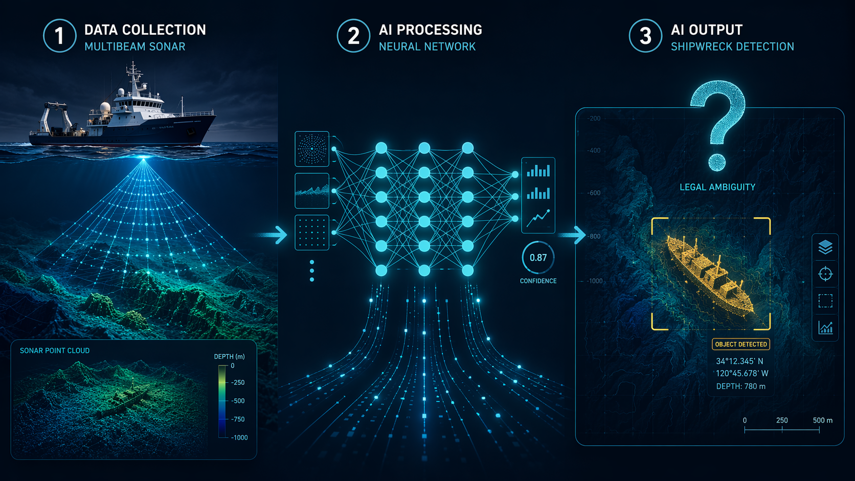
The availability of tools such as ShipwreckFinder matters because legal exposure is no longer limited to a small circle of government hydrographers, naval historians, or specialist archaeological contractors. A QGIS user working with suitable multibeam data may be able to generate plausible wreck targets without building a model from scratch.[2] That changes the scale of potential discovery, and scale changes the reasonableness of ignoring the issue.
For counsel, the first question should not be whether the model is impressive. It should be what kind of decision the model is being allowed to influence. There is a difference between using AI to prioritize archival research, to screen proposed cable routes, to plan a non-intrusive archaeological survey, to support a permit application, or to select a recovery target for a commercial expedition. The same confidence score may carry different legal consequences depending on the intended use.
Training data also matters. Character’s work relied on NOAA and US Navy Underwater Archaeology Branch data from specific US and Puerto Rico contexts.[1] ShipwreckFinder drew on Thunder Bay National Marine Sanctuary and INFOMAR Irish coastal data.[2] A model that performs well in one sedimentary, historical, and sensor environment may not perform the same way elsewhere. Overstating portability can lead not only to bad archaeology, but to bad legal advice: premature notification, missed notification, mistaken exclusion zones, or an expedition premised on a false positive.
That is why the record surrounding the output may become as important as the output itself. Counsel advising an AI-enabled survey project will want to know what data were used, who ran the tool, what version was used, what threshold counted as positive, whether a human reviewed the target, whether alternative explanations were considered, and whether later action relied on the model. Those are not formal elements of a salvage claim. They are the facts that will matter when a regulator, court, insurer, or sovereign claimant asks why the client acted as it did.
AI governance is arriving from outside admiralty
The EU AI Act becomes fully applicable on August 2, 2026. Applying its high-risk logic to AI systems used for cultural heritage detection is an inference as of July 2026; there is no specific Commission guidance on underwater archaeology AI in the materials reviewed here. Still, the Act’s broader structure makes it harder for operators to treat detection systems as mere back-office tools when those systems influence access to, management of, or intervention in protected cultural assets.[9]
The Council of Europe’s 2025 guidelines on AI and cultural policy are also not underwater-specific. Their four-pillar framing — equal access, trust, safety, and cooperation — is broad cultural policy guidance, not a maritime salvage code.[9] Even so, the direction of travel is plain enough for lawyers: AI governance questions will sit beside admiralty questions, not behind them.
That pairing is awkward but necessary. Traditional maritime analysis asks where the wreck lies, what it is, whether it is abandoned, whether a sovereign owns it, what forum has jurisdiction, and whether salvage or finds principles apply. AI governance asks how the system was built, tested, documented, monitored, and used; whether affected institutions or communities had any visibility; and whether the operator understood the limits of automated classification. Neither inquiry replaces the other.
The useful question for lawyers
The question “who is the discoverer?” may be too blunt for the first moment of AI detection. It tempts the parties to argue immediately about reward, ownership, and priority. A better first question is what legal risk event has occurred. Has the client acquired information suggesting the presence of a protected cultural site? Has planned activity changed because of that information? Is the site in a jurisdiction or zone where notification, permitting, or non-interference expectations may apply? Could the target be a sovereign vessel? Can the client explain the model’s limits without turning uncertainty into a litigation strategy?
Those questions do not require treating every AI flag as a legally discovered wreck. They require treating some AI flags as more than idle data. The difference may depend on confidence, context, intended action, jurisdiction, and the nature of the underlying survey. A low-confidence anomaly in a broad public dataset is not the same as a high-confidence target generated for a client preparing a recovery expedition near a historically documented wreck field.
The opening scenario therefore ends in a deliberately unsatisfying place. The model output does not settle ownership. It does not make the operator a salvor. It does not establish abandonment. It does not overcome sovereign immunity. It does not prove that the seabed feature is cultural heritage. But it can trigger due diligence around source documentation, heritage screening, notification strategy, non-interference, and AI system governance.
That is the regulatory gap maritime attorneys must work inside for now. AI detection creates a legally meaningful risk event before traditional salvage law clearly recognizes a legally meaningful discovery event. The safest legal analysis starts there, before the vessel leaves port.
References
- AI spots shipwrecks from the ocean surface — and even from the air, The Conversation, 2021
- ShipwreckFinder: A QGIS Tool for Shipwreck Detection in Multibeam Sonar Data, arXiv, 2025
- Shipwreck detection in bathymetry data using semi-automated methods, Journal of Archaeological Science, 2025
- EX-25-04, NOAA Ocean Exploration, 2025
- Convention on the Protection of the Underwater Cultural Heritage, Wikipedia
- Submerged Cultural Resource Laws and Policies, Neblett Law Group
- Odyssey Marine Exploration, Inc. v. The Unidentified Shipwrecked Vessel, Justia, 2012
- Shipwrecks: Who owns the treasure hidden under the sea?, BBC, 2018
- Council of Europe adopts new guidelines on AI and cultural policy, NEMO, 2025
Comments
Join the discussion with an anonymous comment.